Keystone Edition
Agnes 50: Life After the Flood
6/23/2022 | 56mVideo has Closed Captions
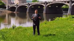
Broadcast live from Nesbitt Park on the banks of the Susquehanna River in Wilkes Barre
50 years ago, life in the Susquehanna Valley changed forever as Tropical Storm Agnes dumped inches of rain and the Susquehanna River inundated homes and streets, destroying everything it touched. Keystone Edition Reports takes a look back at the toll Agnes took, how the valley bounced back, and what the future holds.
Problems playing video? | Closed Captioning Feedback
Problems playing video? | Closed Captioning Feedback
Keystone Edition is a local public television program presented by WVIA
Keystone Edition
Agnes 50: Life After the Flood
6/23/2022 | 56mVideo has Closed Captions
50 years ago, life in the Susquehanna Valley changed forever as Tropical Storm Agnes dumped inches of rain and the Susquehanna River inundated homes and streets, destroying everything it touched. Keystone Edition Reports takes a look back at the toll Agnes took, how the valley bounced back, and what the future holds.
Problems playing video? | Closed Captioning Feedback
How to Watch Keystone Edition
Keystone Edition is available to stream on pbs.org and the free PBS App, available on iPhone, Apple TV, Android TV, Android smartphones, Amazon Fire TV, Amazon Fire Tablet, Roku, Samsung Smart TV, and Vizio.
Providing Support for PBS.org
Learn Moreabout PBS online sponsorshipMore from This Collection
Public affairs and public interest come together in the name of constructive journalism. As the host of Keystone Edition, Larry Vojtko will investigate and explore the impact issues like eviction and homelessness, education, and the strain of COVID have had on all of us.

Video has Closed Captions
Amtrak service from Scranton to New York City is finally about to become reality (26m 59s)
Video has Closed Captions
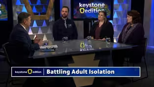
We'll take a look at the issue of adult isolation in Pennsylvania (27m)


Video has Closed Captions
What are school vouchers? How are they funded? What are the pros and cons? (26m 59s)

Video has Closed Captions
We visit the Hazleton integration project to see what's changed and what's to come. (55m 1s)
Video has Closed Captions
Emerging issues in the workforce and maternal health. (53m)
Video has Closed Captions
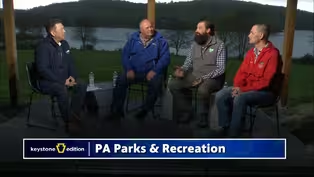
We take a look at the state park system to see what it means to those who visit them (54m 59s)

Video has Closed Captions
How can rural residents get access to the same online resources as higher populated areas? (26m 59s)

Video has Closed Captions
We take a look at the topic of guns and their effect on school safety. (26m 59s)

Video has Closed Captions
The influx of new teachers is shrinking. What can be done? (27m 6s)

Video has Closed Captions
Join us for a townhall where we speak with Congressmen Matt Cartwright and Dan Meuser (55m 19s)
Video has Closed Captions
We explore the STARS Program at Marywood University and the Hazleton Integration Project (26m 59s)
Providing Support for PBS.org
Learn Moreabout PBS online sponsorship- [Woman] At that time I was seven years old, and I do remember standing at the Water Street Bridge in Pittston, watching the river, and roofs, debris, people's houses, cars just flying down the river.
And I remember the river was moving so fast and it was so high, and just people everywhere watching it.
- [Larry] 50 Years later, anyone who lived through it can still remember where they were when the rain from Agnes started to fall, and the flood waters rose.
Looking back at the devastating storm and looking ahead to what's next.
- [Announcer] Live from your public media studios, WVIA presents "Keystone Edition Reports."
A public affairs program that goes beyond the headlines to address issues in Northeastern and Central Pennsylvania.
This is Keystone Edition Reports and now moderator, Larry Vojtko.
(upbeat music) - Hello, I'm Larry Vojtko here at Nesbitt Park right along the Susquehanna River.
The view was very different here June 23rd, 1972.
On this date 50 years ago, this spot was more than 20 feet underwater as the Susquehanna's swelled with the remnants of tropical storm Agnes, and then escaped its banks.
People had to be rescued, and everything in the valley changed forever.
"Keystone Edition Reports" kicks off a night of remembrance of the historic flood.
Following this program, you can watch the WVIA documentary from 1997, "Remembering Agnes."
Followed by the premier of WVIA's neWest original documentary, "Agnes 50: Life After the Flood."
The remembrance coverage wraps up with, "Agnes: the flood of '72," a documentary that explores how what happens upstream affects the Wyoming valley.
In this program, we'll examine how Agnes impacted Pennsylvania?
What we've learned over the past five decades?
And whether a tragedy like Agnes could ever happen again?
Right now, WVIA's Paul Lazar recaps the flood of 1972.
(gentle music) - [Paul] Most people in the Wyoming Valley were affected by tropical storm Agnes, or know someone who was.
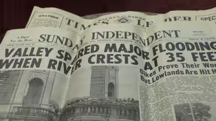
When all was said and done, Agnes left 128 people dead, and more than $3 billion in damage across 12 states.
At that point in time, Agnes was the costliest storm in history.
In June of 1972, Pennsylvania felt Agnes' wrath as the storm settled over the Keystone State, and dumped inches and inches of rain over a five-day period.
Some places saw more than a foot of rain, and water collected in areas where it had nowhere to go.
Nearly every river, creek, or stream throughout the area swelled and inundated nearby communities.
All the tributaries of the Susquehanna swelled as well like Fishing Creek near Bloomsburg in Columbia County.
Damages there reached more than $19 million, and the recovery lasted well beyond 1972.
Lewisburg, along the West branch of the Susquehanna, saw more than a foot of rain.
And most of the downtown was under a few feet of water when the river reached its 34 foot crest on June 24th.
Wilkes-Barre in the heart of the Wyoming Valley saw about six inches of rain during Agnes, and was afforded some protection by the levee system.
However, on June 23rd, the Susquehanna River overtopped the levee and inundated the city, leaving the entire downtown underwater up to 20 feet deep in some spots.
Financial losses in the Wyoming Valley exceeded $1 billion, and recovery efforts took years.
For "Keystone Edition Reports," I'm Paul Lazar.
(gentle music) - We're taking an aerial look over the Susquehanna River, approaching the Market Street Bridge in Wilkes-Barre.
Welcome to this special edition of "Keystone Edition Reports" coming to you live from Nesbitt Park.
This program is the first of four hours of Agnes coverage that WVIA is presenting this evening.
Now let's meet our panel.
Christopher Bellman is the Executive Director of the Luzerne County Flood Protection Authority.
Dave Janoski joins us as well, he's the Managing Editor of "The Citizens' Voice" newspaper here in Wilkes-Barre.
And Mike Bilder is the hurricane program manager at FEMA, the Federal Emergency Management Agency.
Now, if you have questions for any of our guests, please email us or use social channels, keystone@wvia.org.
Meteorologist, Tom Clark, may be a familiar face to many in the Wyoming Valley from his years he spent doing the weather on evening news.
And he sat down with WVIA to explain the circumstances that led to the devastation from Agnes.
(gentle music) - Meteorologists first realized that Agnes was going to be a disaster, was when it was evident that the storm was starting to stall and merge with another storm right over Pennsylvania.
And obviously seeing how high the rivers were getting, and the amount of rain that was falling as the days progressed led to a knowledge that, hey, this is gonna get bad.
Now, the rainfall totals in May of that year were over seven inches, so the soil was already saturated.
And therefore the rainfall that came with Agnes simply was running off into the streams and rivers, which at the time were not capable of handling such an intense amount of rain.
Now, Agnes rainfall was six to eight inches over Luzerne County.
But other areas nearby got over 10 inches of rain.
The highest rainfall from Agnes, 19 inches that was over Schuylkill County.
The path of Agnes was close to the Atlantic coastline.
So that prevented the storm from strengthening and weakening, okay.
So it stayed pretty strong as it was coming north.
Also that path allowed Agnes to tap more humid air from off the Atlantic Ocean.
Now, the major culprit was the merger with another storm.
As Agnes was moving over Pennsylvania, another storm in the upper atmosphere was moving in from the west.
So that upper air storm absorbed the circulation from Agnes, and so the two were stacked up.
The one storm, the upper storm, was directly above Agnes and that accounted for the erratic, counterclockwise looping motion of Agnes.
So again, that was where Agnes unleashed most of her rainfall, right over Pennsylvania.
The extent of flooding that we had from Agnes and Lee will happen again.
When, I'm not sure, but the nature of storms, the nature of the atmosphere, there's bound to be another major flood along the Susquehanna River and the tributaries like we had from Agnes.
It may take another 100 years, it may take another 200 years.
It's pretty rare to have flooding to that extent, but it will happen again.
(gentle music) - Well, a big thank you to Tom Clark for doing that for WVIA.
And we heard how Agnes was a very unusual weather system.
But I'll start with you, Chris Bellman, as head of the Luzerne County of Flood Protection Authority.
The question is, can we now survive another Agnes?
Over these past 50 years, have we learned enough that our region can survive that?
- Well, I would say we could survive another Agnes.
I mean, we experienced that in September, 2011, with the Tropical Storm Lee flood.
The big difference was there was a levee raising a project that occurred from the mid '90s to mid 2000s, which raised a level of protection right behind us here three to five feet.
But also there's been a tremendous significant advances in the weather forecasting and river flood forecasting, which allows us to prepare for these major flood events days in advance, so that we can properly prepare and get the system buttoned up, and to notify the population behind the system of this oncoming threat.
- Mike Bilder, you're with FEMA.
Can you give us an idea of how the federal government has evolved over this time from the time of Agnes to now in its ability to support and react to such emergencies?
- Well, back in that time, we weren't called emergency management, we were called civil defense.
We were primarily focused on the threat of a nuclear attack, which of course it was the height of the Cold War.
So a lot of the activities we were doing were being mostly dictated by that type of response.
And Agnes, because I think where it hit in a heavily densely populated part of the country, the east coast hit areas like Washington D.C., and Philly and just outside New York, and a lot of other big cities, it became clear that you needed more.
Basically a lot of the flaws in the systems were exposed.
And over the rest of the decade of the 70s, the federal government realized they needed a centralized agency that would try to coordinate these efforts between all these other agencies.
And that's how FEMA came out after Three Mile Island, just down the river.
And so after that though, we still had a lot of learning to do.
We've been evolving as an agency, and the federal government as a whole, because it took another 10 years for the Cold War end, and then we had hurricane Andrew.
Then we had 9/11, and even after that, we had hurricane Katrina, again, expose more and more issues with the system.
And every time we have a big event like that, the whole community, the whole profession comes together, and say, "What can we do better?"
It's one thing about emergency managers, is what can we do better for the next time?
And we are at a place where, we do work very closely with the Pennsylvania Emergency Management Agency who in turn works closely with the locals.
And we try to respect the way the states do their things, but we are there to help with all our federal partners to try to get the resources they need when we have our next Agnes.
- Well, this program is the first in a series of four programs this evening, taking a look at Agnes flood and our efforts to mitigate that, and to go forward and prepare for such an event that might happen in the future.
And at nine o'clock, we have a brand new documentary, it's WVIA's newest documentary called "Agnes 50: Life After the Flood."
And Al Monelli is the filmmaker, we'll be hearing from him a little bit later in the program.
But Al went up and down the Susquehanna River base, and he went to all the towns from, not only here in Wyoming valley, but also to Milton and Sunbury, and Danville, and Bloomsburg, and he went up to Bradford and Tioga Counties.
And we got that entire picture of that, so you won't wanna miss that a little bit later on.
But any of us who went through Agnes, we have really firm memories of that time.
And the floods of '72 and 2011 are still fresh in the memories of those who live through them.
WVIA's Kat Boles met with some people in West Pittston who share their stories of what it was like during those floods.
(air whooshing) - [Kat] Ahead of the 50th anniversary of tropical storm Agnes, the WVIA News team spent an afternoon at the West Pittston Library chatting with residents from around the region about the flooding and the aftermath of the storm.
Steve Snyder, who now lives locally, grew on a farm in Buckhorn, right outside of Bloomsburg.
In June of 1972, he was 22 and had just graduated from college.
Snyder's family homestead was around two miles outside of town.
So while they weren't directly impacted by the flooding, he says the experience was still traumatic.
- But we had so many friends that were in town.
And in Bloomsburg, the problem that you had was you had the Susquehanna on one side, and you had Fishing Creek on the other side.
So when the river started backing up and Fishing Creek started overflowing its banks, the lower end of Bloomsburg, the West end, got it from both sides.
And I never forget the one house, it was a brick home, and it had collapsed on itself.
And the man who owned it wasn't allowed to get anything out of it.
- [Kat] David Bauman is the director of the West Pittston Library, he's lived his entire life around the Susquehanna River.
In 1972, he was a child in Lock Haven.
Bauman, his parents, and his siblings were staying at the Shillings, a family friends' home.
- I would've been four going on five.
And remember looking out the window, watching all this rain coming, and Mr. Shilling saying, "Can you believe tomorrow that rain is gonna be in this house?"
I remember standing at the top of the stairs and flood waters, muddy flood waters, are halfway up the stairs.
But then the next memories I have after that standing at the top of the stairs were being handed out the window.
Here at the library in '72, there were only two feet or maybe a couple of shelves worth of water in this building.
But in 2011, it was four feet of water in here.
Books that were in the basement that the friends of the library were storing for their book sales, they were pulling out of the rafters in the basement, and there was just so much mud to remove.
- [Kat] Tom Graziano is from Wilkes-Barre.
He was employed by the art lamp company, but was working in New York City on June 23rd, 1972.
Graziano got a ride out to the city with a truck driver, getting home wasn't as easy.
- I finished my work there, and I called Martz Bus Terminal to make reservations to go back to Wilkes-Barre.
They told me, "Sorry."
I called my wife, and it's amazing that from New York to Wilkes-Barre you could get through.
Local calls, everything was out.
So I asked her, "What's happening?"
She says, "The town is flooded, it's a mess."
I went up on a hill, overlooking the valley, and all you could see was water everywhere.
Then after that it was just a question of, after water went down, cleaning up and trying to get back to normal.
(air whooshing) - Just a reminder directly following this program, you can watch the 1997 documentary from WVIA, "Remembering Agnes" followed by the premier of "Agnes 50: Life After the Flood," and then we have "Agnes: The Flood of 1972."
And how, what happens upstream has an effect here.
Now, Dave Janoski, you and I probably could fill the rest of the time with memories of the flood.
But one of the things that sticks in my mind is a slogan that came out, it was used very frequently there, It was Valley With a Heart, you remember that?
- Yeah, Valley With a Heart was really everywhere in 1972.
It's a phrase that was coined by a radio personality back in the '30s called Little Bill Phillips.
And it was often used as part of charitable campaigns, civic campaigns.
And after he died in 1960, it was used very often.
And right after the flood a group of civic leaders, labor leaders, business leaders, got together and formed a consortium to help the recovery, and that was the slogan that they adopted.
It was the Valley With the Heart coming back better than ever.
And companies that were reopening after recovering and cleaning up would use that logo in their advertisements.
- I remember as a young man, I was in my teens, I remember it kind of giving us a lift.
It kind of helped the community come back together, it helped us have a sense of optimism and it almost was a turning point in the area redefining itself in a way that, at least I feel it that way.
I know Mike, you had mentioned that you even have heard even now from people remembering Agnes of Valley With a Heart.
- Oh yeah, we have a few employees at FEMA Region 3 who were residents here, and that's one of the things they remember that in the flood mud (laughs), among many other memories.
- [Larry] No one can forget the flood mud.
- Yeah, you can never get that smell out of your nostrils.
I've smelled it in different floods but it sticks today.
And I saw a lot of my research too, it kept coming up as well.
- Yeah, so we wanna keep it a valley with a heart, Chris, of course, and keep it all safe.
And I think that when we think, when I think about the flood protection system, first thing comes in mind is the levee, the flood wall.
But the actual flood protection system is much bigger and more complicated than that.
Can you give us a quick overview of what's really involved and how it all works?
- Sure, I mean, the levees in the Wyoming Valley started as a response to the floods of 1936.
So around 1940 that's when flood Texas system was starting to be constructed.
And from essentially 1940 until 1996, when the Luzerne County Flood Protection Authority was created each municipality maintained their section of the flood protection system.
It was an uneven approach, and as part of the levee raising project, which occurred from the mid '90s to mid 2000s, that's when the Flood Protection Authority was created because the federal government, the United States Army Corps of engineers wanted to have a single entity responsible for the overall maintenance and operation of the system.
Today, it's a large and complex civil engineering system that consists of 16 miles of levees and flood walls, 75 draining structures of various types.
We have 130 relief wells on the protective side of the levee toe.
There's 13 pump stations with 39 deep well vertical pumps.
We have extensive electrical distribution system that consists of eight substations, 27 transformers, about nine miles of above and below ground electrical distribution lines.
We have 16 openings in the line of protection, which we have to install what's called closure structures during a high water event, most notably right behind us here at the Market Street Bridge.
And also we have the Toby Creek compounded basement, which is a 28 foot high by a mile long earth and dam in the Pringle borough.
And all these elements need to work together, so that we can have a successful response to any high water flood event.
- Well, it sounds like a very complex system that really requires a lot of knowledge, and engineering, and maintenance, of course.
But let's just take one aspect of that, I've always been curious about and that's the pumping station, okay.
- [Christopher] Certainly.
- We see these around, we know that they're pumping water.
How do they work?
Where does the water come in?
Where does the water go?
How does that all work?
- Well certainly, quite simply during a normal conditions like today, municipal storm water just drains by gravity right to the river.
But during a high water event that gravity flow suddenly becomes blocked.
So the municipal storm water is diverted into our pump stations.
And if you ever go into one of our pump stations you'll see there's the motor control center on the one side, there's the pumps.
And above the floor, you'll see the motors of the pumps, which are about the size of a car.
But below the floor, you've got a chamber that's 30 feet deep, and that's where the municipal storm water goes.
And once it reaches a certain height, we turn on the pumps and the pumps force the water out into the river.
And that's how these municipals stay dry during a flood event.
Together with all of our pumps, we have the capacity to pump out 1.4 million gallons per minute of storm water, - [Larry] Wow.
- From the 12 protected communities behind the system.
- So as I pointed out, there's a lot of work here, so it takes a lot of money.
How is the Flood Protection Authority funded?
- Our only source of revenue is through a levy fee, and that's imposed on the properties located behind the flood protect system that were impacted by the Agnes Flood.
It's about 14,200 properties, and on an annual basis, we get approximately $2 million a year.
- And let me ask you this because some people have complained about the levy fee, and we understand that, sometimes we want the services and we're not that happy to pay for them.
But let me ask you this way, if we hadn't installed the flood protection system that we have now, okay.
Now, what came into being after '72, we had tropical storm Lee come in 2011.
If we had done nothing except restore what we had that was put in 1940, or '36 or '40, what would've happened?
- It would've been an economic catastrophe.
You would've had the Wyoming Valley destroyed twice in one generation.
And I think it would've had severe economic consequences through the whole valley.
I mean, right now you're seeing a lot of investment, you're seeing a lot of development, Wilkes-Barre, the municipality of Kingston and other Riverside communities.
And I think a part of that is these looking at the developers and the investors, they feel that the authority does a very good job in maintaining the flood protection system.
But if levee raising project had never occurred, and I think you would've seen an Exodus of residence from the valley.
I think you would've seen an Exodus of investors, and the businesses, and I think the valley would look much, much different than it does today.
- Mike Bilder, let's talk about how some decisions are made on the FEMA end of things.
And connecting in with the local authorities about how to plan for these?
What are the criteria used to develop a plan for a levee system, or mitigation, or allowing for green space downstream or something?
What goes into these formulas?
- Well, in fact we just updated a number of our formulas for the premiums for flood insurance, some of of your viewers may have heard of that.
That's we call 2.0, and that is a very complicated process, they try to revise it.
And so there's a lot that goes into it, and there's a lot of work we have to with do with the local flood plane managers with the Commonwealth of Pennsylvania to come up with a good plan.
And just a lot of criteria gets involved in that, and you could probably spend a whole day talking about it.
And I know that Chris does a lot of work, he kind of sees the other side of it as well.
He could probably speak to maybe some more of the more details in this area.
- So Chris, do you have anything to add to that issue of how it's decided, what, where?
Is it going to be a restraint project?
Is it gonna be a wall?
Is it going to be a pumping station?
Are we going to modify the waterways, the creeks feeding into it?
I would imagine that this decision-making is really dependent on the particular situation of the topography, and what the average flooding rate would be things of that sort.
- Well, Larry you're right.
I mean, as part of the levee raising project, I mean, although the physical construction is complete, there's still a mitigation program that we were trying to complete as well.
And the mitigation program was set up to address any adverse effects from the levee raising project in the community's upstream and downstream from the flood protect system in Luzerne County, Columbia, Northampton, Montour, and Snyder.
And typically the projects that we fund, they're acquisition, demolition type projects, raising structures, flood proof and commercial structures, and small civil works projects.
- Okay, so it seems like there's kind of been a shift in philosophy of how to then mitigate the potential for flooding over the years, is that true, Mike?
- Yeah, I think traditionally back in the day, the idea was build the wall, try to keep it away.
And I think over time, and it's in fact, when look at the research even 50 years ago, the time at Agnes, there was a group of people who are like, "No, no, we can't just build walls.
"We have to do a much more diverse approach "where we try to get people out of the flood plains "if we can, if we can convince them to do so."
And those type of efforts, or just trying to prevent certain types of development happening in areas that are particularly at risk.
It's a multifaceted approach, and I think that's very important.
You just can't focus strictly on building levees, and building dykes and walls.
Although again, those are very effective means of mitigation, I don't wanna take that away from that type of- - Right, it's important to remember the water has to go somewhere.
And so if you're putting up and restraining the flow of the river at one point, it's going to affect somewhere downstream or upstream.
And I'm thinking about a community north of here, West Pittston.
And there has been, in 2011 West Pittston got hit much worse than in 1972.
And there has been some controversy around why the levee was stopped just south of West Pittston?
Why wasn't it extended?
And Dave, you probably are familiar with this story, and what has occurred over the years.
Tell us a little bit, - Yeah, it's interesting in the report, Larry, that the gentleman in the library mentioned that in '72, they had up to the second shelf and much higher then in 2011- - Right, and I think we have to point out that the reason that was is because the levee failed in '72 and Forty Fort, and so the water has to go somewhere, and it shot out like a hose out of there, and so West Pittston didn't.
But now the levee held in 2011, so it pushed it back up to West Pittston and into Duryea.
- Well, back when they were first discussing the levee raising project in the '90s, West Pittston actually was part of the project in the preliminary stages.
There was actually some resistance to putting a levee in West Pittston among residents back then.
I think the Army Corps and the county held a public hearing, 150 people, maybe only five or six were in favor of putting a levee in West Pittston 'cause people felt it would kind of ruin the nice river common that they have there, Cherry Blossoms, et cetera.
I think those attitudes changed over time.
And especially now after 2011, I think there's a lot of support for a levee, but the Army Corps ruled back in the '90s that it wasn't cost-efficient to build one, and they still maintain that position today.
It would cost about $60 million, they say to build a levee.
- Yeah, and of course, as time goes on, it'll cost more and more as cost rise.
Now, what we're going to find in Al Monelli's film, "Agnes 50: Life After the Flood," is that there are some people who push back on that day, that they say, "That's not the case, "that we did want the levee."
And it's going to be interesting to view that in the documentary.
So that has long been a topic of conversation within the Wyoming Valley is West Pittston because people who are not familiar with West Pittston, there are lovely, lovely, old homes that just are on Susquehanna avenue, so named because of the river.
And that's where this idea that they didn't want it affecting their view of the river.
And we hear that also from some of the communities downstream as well from there.
We do have to learn that we have to live with the river, so we have to find these other ways of trying to be realistic, that it's going to flood.
And Chris, you mentioned these other mitigation efforts that are in the planning stages.
How important it is, you mentioned that it's a constituent counties are in this plan.
How important is it that we work together as a region to make this possible for us to control our residential areas, our businesses, and keep it thriving?
- Well, Larry is very, very important.
I mean, flood waters, they don't understand jurisdictional boundaries.
So it's very important that all the entities along the river, that we cooperate, that we work together so that we can safeguard our communities.
- So there are some folks downstream, in the Bloomsburg, Danville area who say that what we've erected here in Wilkes-Barre is causing problems downstream.
So what's your answer to that?
Do you foresee that, that is a well founded argument, or are there plans in place to address those particular concerns?
- Well, I think those concerns were real.
I mean, as part of the levee raising project, they understood that and that's why they instituted the mitigation program as part of the project in the five county region, which we are still continuing to complete.
- Now, Mike, let's talk about other types of mitigation efforts and the subject of dredging comes up all of the time.
Let's talk about dredging the Susquehanna River.
Why has that never been embraced?
- Well we were talking about before with Chris, and Chris can definitely add to this conversation 'cause he's been at the forefront of that conversation.
But one of the reasons, it's not a navigable river.
A lot of the places that do the dredging are these very port areas or other areas where they have a lot of water commerce.
That's not really what the Susquehanna is.
Susquehanna is a shallow River.
- So there's an economic part in this decision-making of whether to dredge or not as well.
- Yeah, and most things in public policy, in public administration is cost-benefit analysis.
And I can hand it over to Chris who can talk a little bit more about this specific stretch.
But it's just a matter, from what I understand, it's just a matter of it not really making that much sense from an economic standpoint and from practical standpoint, and Chris can talk more to that.
- Yeah, I can certain you add to that.
I mean, there's a lot of utility lines that cross beneath the river, they would have to be relocated deeper.
There's a lot of bridge spans right here at the Market Street Bridge.
those piers and the abutment, they would have to go deeper and be strengthened.
There's a lot of aquatic wildlife that lives along the river, that would essentially be an environmental Holocaust, I mean, they would be eliminated.
And then you have to question, you've millions of gallons of sediments, where do you deposit it to allow that material to drain?
And we can do all that, I mean, it's a very sediment-laden river, and the settlement's gonna fill up again within a few years.
So to go through a dredging effort with all those criteria, it'd be a fruitless effort.
- Another issue that comes up frequently is the idea of flood insurance.
Now, prior to '72 I think very few people had flood insurance, Dave?
- Right, in Wilkes-Barre two properties had flood insurance at the time of the flood.
That program started in 1968, and most of the local towns hadn't done the type of flood protection work that would qualify them for that program.
After Agnes, it was more widespread, there was some changes in the program.
I think now there are something like 5,000 or 6,000 riverside properties that are part of that National Flood Protection.
And I know Mike and I were talking about how they have this new 2.0 program that is actually gonna raise rates for maybe 3/4 of those people.
- Well, I had seen that what, the new flood maps out that could adjust perhaps a residence that wasn't in the flood area, is now in the flood area.
Is that the case is?
- I think in West Pittston the new maps would increase the number of properties from 500 to 800.
- And how does one find out if your property is in this situation?
I mean, does the federal government send out a letter to you saying (chuckles), "You better get some flood insurance?"
- Well, one of the ways you could do is go to flood smart.gov.
Flood insurance is a major operation of FEMA, and we have an entire sub-agency dedicated to, we call it FIMA, it's dedicated to the administration of the NFIP, the Flood Insurance Program, as well as a lot of these other mitigation projects, it's a major part of our federal operation.
So they do have a lot of material out there, a lot of resources for folks to look up to see what their risk is.
And that's one of the most... that's the first thing you have to do before getting flood insurance or anything like that, is what is your risk?
What is your risk?
And you have to look at that.
Even if you don't live in a flood zone, still look up, see what your risk is and prepare for any eventuality.
That's one of the most important takeaways for Agnes, is you can't just assume it's not gonna happen.
- Right, you have to assume it is going to happen.
- [Mike] Yes.
- And it seems the rates have gone up quite a bit.
Correct me, if I'm wrong, Dave, if you have this information.
But the Federal Flood Insurance Program had been subsidized by the federal government, so it artificially kept the rates down from what the actual risk is, am I on the right track there?
Is that what you're reporting is.
- Yeah, no, I think the average policy in Pennsylvania, I think is now $1,300.
- $1,300.
- Which for some people is maybe what they're paying in property taxes to their County.
But some of the rates might go up a couple hundred dollars a year with this new program.
Some may go $1,000 higher.
The program really, they're trying to restore some fairness.
I think there was a feeling that more expensive properties weren't paying their fair share.
So I think the higher-end homes are likely to see an increase while lower priced homes will likely see a decrease.
- Right, right, so the idea here is that if you want to live near the river, you have to assume some risk, you have to know what you're getting into.
And so if you have a mortgage on the house, just as if you have to have homeowner's insurance, you'll have to have the flood insurance.
So I think that's how it would work, right Chris?
- That's correct.
I mean, flood insurance premiums is based on risk.
So if you live adjacent to a waterway, chances are very good that you'd be paying a higher premium versus someone who lives more inland.
- So again, we have to learn how to live with the river.
We want to make sure that- - That's correct.
- We love to be near the river.
We love to make use of it for recreational purposes, but by the same token we have to be realistic, and we have to prepare for the eventuality.
Well, we're gonna learn a little bit more about this as we explore throughout the evening in a series of documentaries.
And later WVIA will be premiering its new documentary, "Agnes 50: Life After the Flood."
It's the work of WVIA's newest filmmaker, Alexander Monelli.
In making the film, he tells the stories of the people whose lives were affected 50 years ago, and how those effects are still being felt in 2022.
(gentle music) - WVIA has become known over the years as the home for documentary filmmaking in the region.
25 years ago, we produced "Remembering Agnes," which was a documentary about Tropical Storm Agnes, looking back, telling stories, seeing all of that old destructive footage of just how devastating tropical storm Agnes was to our area.
Now, 25 years later for the 50th anniversary, we've produced "Agnes 50: Life After the Flood."
What we did to separate this documentary, we didn't want to just remake "Remembering Agnes."
So we went into a new direction, we do talk about Agnes, and show footage, and tell some of the old stories.
But the goal of this documentary was to bring it into 2022, 50 years later.
How is Agnes still impacting us to this day?
Flooding is the number one threat in Pennsylvania, and there's still not a perfect solution, every town is different, every region is different.
So this film really investigates, what do we need to do?
What is causing the issue?
How can we solve it?
What are the best ways?
And everything ties back to Agnes.
Agnes was really this big, once-in-a-lifetime storm.
And since then, we've had sort of what I call the Agnes sequel, Tropical Storm Lee in 2011, and that becomes a big part of this documentary.
And flood mitigation, and flood insurance, and all these sort of political issues that you wouldn't think about that go into flooding.
We investigate and we go into in this documentary, and I think it'll raise a lot of great questions.
(gentle music) - Well, just a reminder, our Agnes remembrance coverage continues all night.
Next, you can watch the 1997 documentary from WVIA that marked the 25th anniversary of Agnes called "Remembering Agnes," followed by the premier of the film that Al was just talking about, "Agnes 50: Life After the Flood."
"The Flood of '72" rounds out the coverage and looks at how, what happens upstream has an effect down here.
Now, in the documentary, there is a section, a couple of sections on The Isle of Que, and Al has talked with resident of the Isle of Que down around Selinsgrove.
Now, Mike, you grew up in the area, are you familiar with the Isle of Que?
Can you describe it for us?
- Yeah, I was born in Lock Haven in Pennsylvania, which was very hard hit by Agnes.
But I was born 12 years after Agnes, I wanna make that clear.
But I grew up in Wellsboro Pennsylvania, up in north central PA.
But spent a lot of time down the Williamsport area, definitely going back and forth to Harrisburg, and going through Selinsgrove.
And near Selinsgrove there is an island in the river, the Isle of Que.
The people who live on that island, they are river people, they embrace that lifestyle.
That it's part of their heritage, they're very familiar with what the risk is there.
And their family's heritage is with flooding, and very long history of flooding on the Susquehanna River.
And Isle of Que is a very vulnerable spot.
- Right, and what's interesting in the documentary, the gentleman, the resident there in the documentary talks about how it's important that you realize where you live and you embrace that.
He makes the point that, have a boat, you gotta have a boat, so that you can get off the island if you need to.
That you should never be stuck with having an emergency personnel come and rescue you, it's so dangerous.
When you're rescuing somebody, you could probably talk to that, what goes into that?
What are the dangers for the emergency responders in answering this in a flood emergency?
- Oh, if flooding conditions, or even if it's in the middle of the storm itself, if we are in the middle of Tropical Storm Agnes, the winds of that strength, even just 40 miles per hour, or a little bit stronger than that, there's still extremely hazardous conditions.
And when first responders have to go out into those conditions, they are putting their lives on the line.
And in fact, we lost a first responder during Agnes here in Wilkes-Barre in the middle of a rescue, and he fell off a boat, so he was swept off a boat.
So just know that when you don't evacuate, you are potentially putting the lives of first responders, if they're authorized to go get you.
There are times where first responders are not gonna go out into certain conditions to try to get you if it's extremely hazardous to them, 'cause they don't wanna lose, if there's ten first responders, you don't wanna lose 11 people.
And so there's some decision-making there, it's like, when can we send them out?
But even when they are going out, they are still putting their lives on the line.
And when you don't evacuate, you are potentially setting up for the tragedy to inflict on several other families.
- Right, and so another reason why you have to have a plan.
- Yep.
- You have to know what you're getting into.
And Chris, we look at the river as it is right now, very placid, and you get on there with a kayak, or a boat go a little fishing, but that's not the condition during a flood.
Give us an idea of how that river changes when now 40 feet, it's 40 feet high.
- Well, yeah, it's really hard to believe 'cause right now I think, we have a river stage about four feet.
What we witnessed it with Tropical Storm Lee back in 2011 came close to 41 feet, which is very close to the existing top of protection.
But anytime it gets above 30 feet, it's to us, it's a major flood event.
And the forecast is gonna be 30 feet and higher, we are fully mobilized, we're throwing up all of our closure structures most notably the Market Street Bridge.
All of our pump stations are activated, and it's a lot of sleepless nights.
- And you have debris coming down.
- Absolutely - You have the various the rivers streams within there, the river's just churning and moving so quickly.
It really is a hazard for any emergency personnel to get on that river - Absolutely.
- And try to save somebody.
Now, in the documentary "Agnes 50: Life After the Flood," we hear from meteorologist and climate scientists about the changing climate, climate change, and how it's warming, we get different weather patterns that are more severe, that these severe weather patterns or events that we're talking about, Agnes, Lee are going to happen more frequently.
So the public authorities, do you take this into account?
Are you keeping track of this?
Do you do the research in the climate science in preparing and putting forth your plans, Mike?
- Yes, and we care a great deal about it.
And especially in our part of the country, the one impact of climate change that we are focused on is extreme rainfall.
That is the hazard that takes the fewest ingredients to go right for something to go horribly wrong.
For us to get the big category three or four storm going up the Chesapeake Bay or the Delaware Bay, a lot of things have to go very right in order for that to go wrong.
And there's a lot of opportunity for something to change, and for that not to happen.
You don't need much to have a system like Agnes, and we've had a couple examples in recent years, of 2016 the Baton Rouge Flood down there in Louisiana.
It was just a blob, a tropical moisture, didn't even have a name, we call it the No-name storm 2016 because it didn't have a name, and it just came out and created this horrific flood in there in Louisiana.
Locally in 2006, we had a very complicated weather system in late June of 2006.
And there was tropical moisture, tropical system that was just kind of hanging off, off the east coast that was feeding a much larger complex system, and that caused floods all throughout this part of the region.
And again, you don't need these big, well-organized storms in order to get that.
And because of that we do a lot of scenario building, we do a lot of, well, what if this happened?
What if Agnes happened today?
One of our scenarios that we use for planning is we recreate Agnes today.
How many commodities we need?
How many trucks would we need to send where?
How many people would have to be sheltered?
How many people potentially would have to get housing afterwards?
And all these things, and each storm is different.
So it's not like the next Agnes will be exactly the same, but we try to use at the plan for the ballpark, and we work with the Commonwealth of Pennsylvania, and the other states, and then they work for the locals, the other authorities as well.
The other partners really come together, one thing for viewing audience to know is that we work on this 365 days a year.
We are constantly worried about the next Agnes, we are constantly planning about the next Agnes.
And that is just what we do, that's what we're paid to do.
And so there's a whole legion of people in the government and outside the government who are working diligently to get ready for the next Agnes.
- Now, Dave, you and I grew up in the area.
It seems to me that some of these scenarios, these weather events that are these torrential, almost tropical downpours has caused flooding to people who didn't expect flooding.
Up in the Hills, along the streams and creeks.
- Right, even, well, the back mountain area and Toby Creek, I forget if it was maybe 10, 12 years ago really, flooded a whole bunch of homes long its banks.
- Yeah, Abraham Creek coming down off of West Eighth Street.
And there were just chunks out of what we would call the back road there, taken out by this flash flood of a streaming creek.
So we have to just be realistic and know that this is going to happen, and.
- Well, we were talking about the higher flood insurance rates and climate change.
And I'm wondering maybe these gentlemen can address this a little bit.
There seems to be a kind of a movement toward scaling back what you build along the coasts or along the rivers.
And it seems that some of this mitigation you're doing of taking out properties that are flood-prone, the increase in flood rates, how do you see that affecting Riverside communities like West Pittston in the long run?
- Dave, you're you're correct.
I mean, the trend now is not to have massive civil works projects.
I mean, that was something we did '30s, '40s, '50s, and '60s, the trend is not to do that today.
Today we wanna make communities more resilient, but something that we're doing with the flood protection system.
Yeah, I mean, there's no plans to have another levee raising project.
But we're involved with projects right now to, what I referred to before we have 16 openings line of protection, a lot of them were sandbags, which are brutish affairs takes a lot of labor, resources, it takes a lot of time.
We are involved with a project where we are eliminating four of those locations, and we are converting three sandbag locations to a sliding gate, stop log, which is gonna really improve our flood fighting efficiency and effectiveness.
Another project that's in the planning phases right now, it's kind hard to believe, but we're approaching a quarter century since the closing of the end of the levee raising project.
So at our pump stations, all the electrical components are about 25 year years old now.
So we're planning a, that's gonna be $1 million project where we are going to replace all those existing electronic components so that our system is reliable, and we're gonna have it here for another 80 years.
- But just to get back to today's point about changing some of the, taking the residents away from the river, and changing some of the area into green space.
That does take away from the tax base, from the municipalities.
How do face, that's a problem, isn't it?
Where the municipality could push back on that.
- With a lot of municipalities, they do not want to lose the tax base.
A lot of 'em just aren't in favor with the acquisition demolition.
I think their preferences is to have a structure raising- - [Larry] So you put them up on stilts?
- Yes, and you allow the flood waters to pass below the structure.
The only thing you're allowed to have essentially beneath the residence is, well, you can park your car there.
- We see that a lot on the shore, when you get to the shore.
- You see a lot at the shore.
You don't see it a lot here.
There's a few examples.
- But that's an option for somebody who wants near the river.
- Yes, it is.
- I think it really, what we're kind of getting at is we as public servants who have to work in this realm, we have to balance that, there's business interests, there's just individuals interests.
But we also have the public interest, we have public safety interests.
And it's very complicated, and in our country we would like to balance that out.
And it's something we're dealing with on the coast, you were mentioning, everybody gravitates to the water, especially the ocean.
And in our part of the country where we were building our towns before the railroad.
So where are we building our towns and cities?
Along the river, so we have generations of people who live in these spots, and it's a big balance that our country has to make.
- I was thinking, when I was preparing for this show that we often talk about Tornado Alley in the middle of the country.
I mean, are we living in Flood Alley?
- So our part of the country is particularly prone.
A lot of the times, A, a lot of the remnants of these systems kind of naturally start moving over us at some point, even if it makes landfall in Louisiana, it's gonna probably come up.
The big thing with us is the Appalachian Mountains.
If we get the air moving in just the right direction, you get the upward motion of the air, which then enhances the rainfall itself.
And then the mountains, and the steep terrain, and the hilly terrain of the Piedmont, like the foothills, where we've built a lot of our cities and towns in our part of the country and our Piedmont.
Those areas then the water comes down very violently, and that causes problem, and the big drains in these big rivers where we build the big cities.
And on top of it with a lot of development in the foothills, a lot of that concrete, more concrete equals more runoff, which is bad.
So we've seen a lot of these examples just something about our part of the country, and we're particularly prone to flooding like this.
- Well, Dave, there are homeowners around here, who've been here, maybe even generations.
And their are property gets flooded, again, and again, and again, and they rebuild, flood and they rebuild.
In your reporting and your experience, what keeps them coming back?
- Well, I think nobody wants to leave the family home.
I mean, there's a lot of memories associated with that.
There are people who live along the river in Falls, people down at Shickshinny who really love being by the river, to come out in the morning, and to have a cup of coffee, and watch the river flow by and the wildlife that's there.
I think there were some buyouts in Shickshinny where people really turned them down, and just chose to stay where they were.
We talked about the Isle of Que, I mean, it's hard to give up that tradition, that love of home, even if that means you put up with some destruction every 20 or so years.
- So again, it's about community, it's about being near the river with nature, but still trying to learn how to live with nature in a reasonable way.
That's our challenge as we go forward and we make our home here in a beautiful part of the country.
Well, I really enjoyed our conversation, and it's really coming to an end pretty, pretty quickly.
And I want to thank you.
I want to thank Christopher Bellman, Dave Janoski, and Mike Bilder.
Well, stay right here if you wanna see more stories about hurricane Agnes and the historic flood of 1972.
Coming up next is an Encore presentation of the 1997 documentary "Remembering Agnes," followed by the premier of WVIA's newest original documentary "Agnes 50: Life After the Flood."
And the documentary film, "The flood of '72" rounds out the Agnes remembrance coverage here on WVIA.
And you can also watch "Agnes 50: Life After the Flood, anytime on WVIA Passport.
Learn more and keep informed.
And remember, you can view this episode anytime online@wvia.org.
I'm Larry Vojtko, thank you so much for watching.
(upbeat music)
Agnes 50: Life After the Flood - Preview
Broadcast live from Nesbitt Park on the banks of the Susquehanna River in Wilkes Barre (30s)
The WVIA News team recently visited the West Pittston Library to hear from area residents (3m 34s)

Providing Support for PBS.org
Learn Moreabout PBS online sponsorship
- News and Public Affairs

Top journalists deliver compelling original analysis of the hour's headlines.

- News and Public Affairs

FRONTLINE is investigative journalism that questions, explains and changes our world.


Support for PBS provided by:
Keystone Edition is a local public television program presented by WVIA